
Long'an County topographic map
Interactive map
Click on the map to display elevation.
About this map
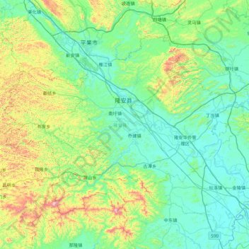
Name: Long'an County topographic map, elevation, terrain.
Location: Long'an County, Nanning, Guangxi, China (22.84582 107.32456 23.35239 108.08710)
Average elevation: 837 ft
Minimum elevation: 217 ft
Maximum elevation: 3,291 ft
Other topographic maps
Click on a map to view its topography, its elevation and its terrain.