
Kawah Ijen Crater Lake topographic map
Interactive map
Click on the map to display elevation.
About this map
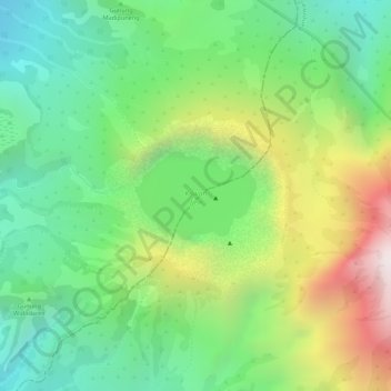
Name: Kawah Ijen Crater Lake topographic map, elevation, terrain.
Location: Kawah Ijen Crater Lake, Banyuwangi, East Java, Indonesia (-8.06181 114.23771 -8.05449 114.24591)
Average elevation: 7,136 ft
Minimum elevation: 5,961 ft
Maximum elevation: 8,999 ft
Other topographic maps
Click on a map to view its topography, its elevation and its terrain.
Gunung Ijen
Indonesia > East Java > Banyuwangi
Gunung Ijen, Banyuwangi, East Java, Indonesia
Average elevation: 1,670 ft