
Upper Grand Lagoon topographic map
Interactive map
Click on the map to display elevation.
About this map
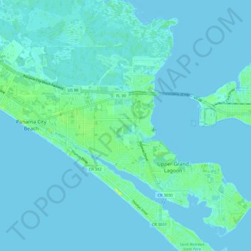
Name: Upper Grand Lagoon topographic map, elevation, terrain.
Location: Upper Grand Lagoon, Bay County, Florida, United States (30.12953 -85.79272 30.22307 -85.68469)
Average elevation: 7 ft
Minimum elevation: -3 ft
Maximum elevation: 56 ft