
Apalachicola topographic map
Interactive map
Click on the map to display elevation.
About this map
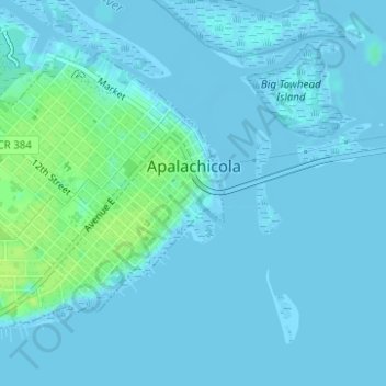
Name: Apalachicola topographic map, elevation, terrain.
Location: Apalachicola, Franklin County, Florida, 32320, United States (29.71345 -85.00469 29.73366 -84.98030)
Average elevation: 7 ft
Minimum elevation: -16 ft
Maximum elevation: 43 ft
Other topographic maps
Click on a map to view its topography, its elevation and its terrain.
Saint George Island
United States > Florida > Franklin County
Saint George Island, Franklin County, Florida, United States
Average elevation: 3 ft
Saint George Island
United States > Florida > Franklin County
Saint George Island, Franklin County, Florida, 32328, United States
Average elevation: 7 ft
Carrabelle
United States > Florida > Franklin County
Carrabelle, Franklin County, Florida, United States
Average elevation: 10 ft
Eastpoint
United States > Florida > Franklin County
Eastpoint, Franklin County, Florida, United States
Average elevation: 7 ft