
Skierniewice topographic map
Interactive map
Click on the map to display elevation.
About this map
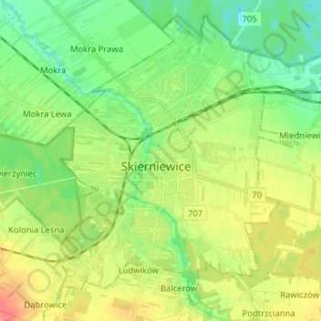
Name: Skierniewice topographic map, elevation, terrain.
Location: Skierniewice, Łódź Voivodeship, Poland (51.92251 20.10505 51.99369 20.23337)
Average elevation: 417 ft
Minimum elevation: 341 ft
Maximum elevation: 528 ft