
Kokstad topographic map
Interactive map
Click on the map to display elevation.
About this map
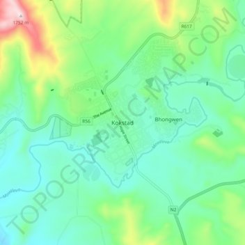
Name: Kokstad topographic map, elevation, terrain.
Location: Kokstad, Sisonke District Municipality, KwaZulu-Natal, RSA (-30.58750 29.38444 -30.50750 29.46444)
Average elevation: 4,390 ft
Minimum elevation: 3,924 ft
Maximum elevation: 5,768 ft