
Malekula topographic map
Interactive map
Click on the map to display elevation.
About this map
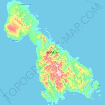
Name: Malekula topographic map, elevation, terrain.
Location: Malekula, Malampa, Vanuatu (-16.58954 167.15358 -15.87878 167.83530)
Average elevation: 226 ft
Minimum elevation: 0 ft
Maximum elevation: 2,766 ft
Other topographic maps
Click on a map to view its topography, its elevation and its terrain.