
Wertheim topographic map
Interactive map
Click on the map to display elevation.
About this map
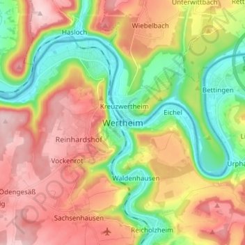
Name: Wertheim topographic map, elevation, terrain.
Location: Wertheim, Main-Tauber-Kreis, Baden-Württemberg, 97877, Germany (49.72150 9.47554 49.80150 9.55554)
Average elevation: 797 ft
Minimum elevation: 433 ft
Maximum elevation: 1,191 ft