
Kampung Raja topographic map
Interactive map
Click on the map to display elevation.
About this map
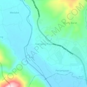
Name: Kampung Raja topographic map, elevation, terrain.
Location: Kampung Raja, Badar, Aceh Tenggara, Aceh, Indonesia (3.50660 97.76504 3.54660 97.80504)
Average elevation: 817 ft
Minimum elevation: 587 ft
Maximum elevation: 1,837 ft