
Marblehead topographic map
Interactive map
Click on the map to display elevation.
About this map
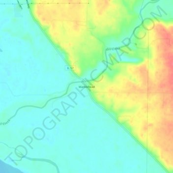
Name: Marblehead topographic map, elevation, terrain.
Location: Marblehead, Adams County, Illinois, United States of America (39.81977 -91.38848 39.85977 -91.34848)
Average elevation: 522 ft
Minimum elevation: 453 ft
Maximum elevation: 650 ft