
The Fleet topographic map
Interactive map
Click on the map to display elevation.
About this map
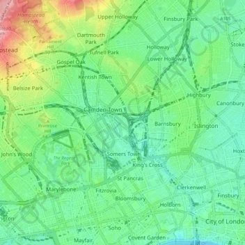
Name: The Fleet topographic map, elevation, terrain.
Average elevation: 135 ft
Minimum elevation: 7 ft
Maximum elevation: 443 ft
Other topographic maps
Click on a map to view its topography, its elevation and its terrain.
City of London
United Kingdom > England > City of London > City of London
City of London, England, EC2V 5AE, United Kingdom
Average elevation: 138 ft