
Koynanagar topographic map
Interactive map
Click on the map to display elevation.
About this map
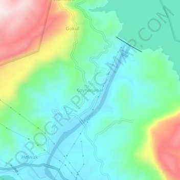
Name: Koynanagar topographic map, elevation, terrain.
Location: Koynanagar, Patan, Satara, Maharashtra, 415207, India (17.37198 73.72223 17.41198 73.76223)
Average elevation: 2,320 ft
Minimum elevation: 1,883 ft
Maximum elevation: 3,399 ft