
Ravet topographic map
Interactive map
Click on the map to display elevation.
About this map
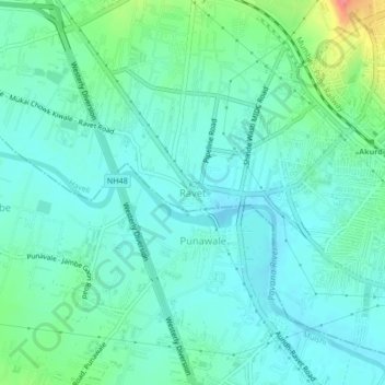
Name: Ravet topographic map, elevation, terrain.
Location: Ravet, Haveli, Maharashtra, 412101, India (18.62327 73.72506 18.66327 73.76506)
Average elevation: 1,890 ft
Minimum elevation: 1,834 ft
Maximum elevation: 2,087 ft
Other topographic maps
Click on a map to view its topography, its elevation and its terrain.
Sinhagad
India > Maharashtra > Haveli
Sinhagad, Haveli, Maharashtra, 411025, India
Average elevation: 3,261 ft
Pimpri-Chinchwad
India > Maharashtra > Haveli
Pimpri-Chinchwad, Haveli, Pune, Maharashtra, 411017, India
Average elevation: 1,985 ft
Haveli
India > Maharashtra > Haveli
Haveli, Pune District, Maharashtra, India
Average elevation: 2,116 ft