
Xeresa topographic map
Interactive map
Click on the map to display elevation.
About this map
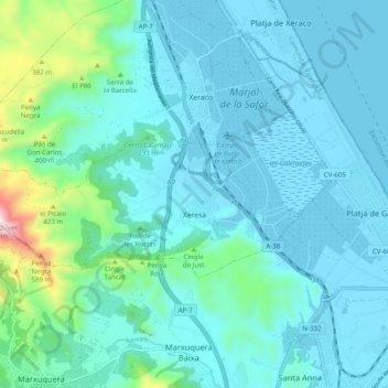
Name: Xeresa topographic map, elevation, terrain.
Location: Xeresa, Safor, Valencia, Spanje (38.99769 -0.27973 39.03066 -0.18186)
Average elevation: 354 ft
Minimum elevation: -7 ft
Maximum elevation: 2,618 ft