
Morondava topographic map
Interactive map
Click on the map to display elevation.
About this map
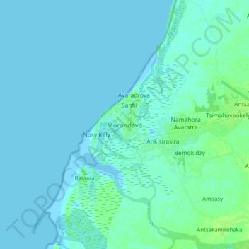
Name: Morondava topographic map, elevation, terrain.
Location: Morondava, Menabe, Province de Toliara, Madagascar (-20.33511 44.23861 -20.25511 44.31861)
Average elevation: 10 ft
Minimum elevation: -3 ft
Maximum elevation: 36 ft
Other topographic maps
Click on a map to view its topography, its elevation and its terrain.