
Golpayegan topographic map
Interactive map
Click on the map to display elevation.
About this map
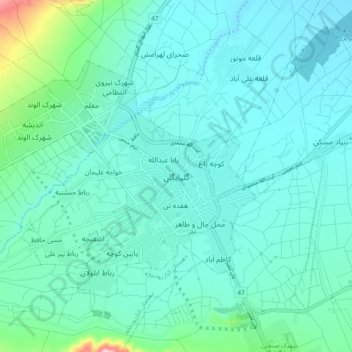
Name: Golpayegan topographic map, elevation, terrain.
Location: Golpayegan, بخش مرکزی, Isfahan Province, Iran (33.41649 50.24833 33.49649 50.32833)
Average elevation: 6,017 ft
Minimum elevation: 5,869 ft
Maximum elevation: 6,864 ft