
Cloverdale topographic map
Interactive map
Click on the map to display elevation.
About this map
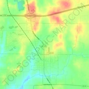
Name: Cloverdale topographic map, elevation, terrain.
Location: Cloverdale, Putnam County, Indiana, United States (39.50061 -86.82765 39.53813 -86.77373)
Average elevation: 804 ft
Minimum elevation: 702 ft
Maximum elevation: 922 ft
Other topographic maps
Click on a map to view its topography, its elevation and its terrain.
Bainbridge
United States > Indiana > Putnam County
Bainbridge, Putnam County, Indiana, United States
Average elevation: 922 ft
Reelsville
United States > Indiana > Putnam County
Reelsville, Putnam County, Indiana, 46171, United States
Average elevation: 689 ft
Fox Ridge
United States > Indiana > Putnam County > Greencastle > Fox Ridge
Fox Ridge, Greencastle, Putnam County, Indiana, 46135, United States
Average elevation: 820 ft