
Muroran topographic map
Interactive map
Click on the map to display elevation.
About this map
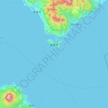
Name: Muroran topographic map, elevation, terrain.
Location: Muroran, Iburi Subprefecture, Hokkaidō Prefecture, Japan (42.10632 140.65601 42.43726 141.34872)
Average elevation: 151 ft
Minimum elevation: -7 ft
Maximum elevation: 3,537 ft
Other topographic maps
Click on a map to view its topography, its elevation and its terrain.
Kamikawa District
Kamikawa District, Tokachi Subprefecture, Hokkaidō Prefecture, Japan
Average elevation: 1,578 ft