
Jangan-eup topographic map
Interactive map
Click on the map to display elevation.
About this map
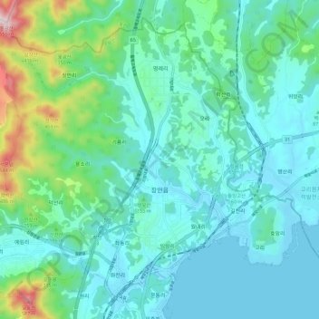
Name: Jangan-eup topographic map, elevation, terrain.
Location: Jangan-eup, Gijang-gun, Busan, 46036, South Korea (35.30762 129.19459 35.38922 129.30668)
Average elevation: 374 ft
Minimum elevation: 0 ft
Maximum elevation: 2,064 ft