
Immokalee topographic map
Interactive map
Click on the map to display elevation.
About this map
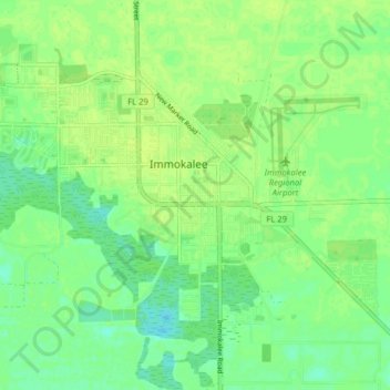
Name: Immokalee topographic map, elevation, terrain.
Location: Immokalee, Collier County, Florida, United States (26.39640 -81.46272 26.44391 -81.38344)
Average elevation: 33 ft
Minimum elevation: 7 ft
Maximum elevation: 49 ft