
Nobella topographic map
Interactive map
Click on the map to display elevation.
About this map
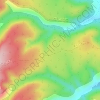
Name: Nobella topographic map, elevation, terrain.
Location: Nobella, Albarracín, Teruel, Aragón, España (40.26012 -1.43892 40.28012 -1.41892)
Average elevation: 4,662 ft
Minimum elevation: 4,193 ft
Maximum elevation: 5,207 ft
Other topographic maps
Click on a map to view its topography, its elevation and its terrain.
Fuente Garcia (origen del Tajo)
España > Aragón > Albarracín
Fuente Garcia (origen del Tajo), A-1704, Casa del Tio Pequeño, Albarracín, Teruel, Aragón, España
Average elevation: 5,341 ft