
San Rafael topographic map
Interactive map
Click on the map to display elevation.
About this map
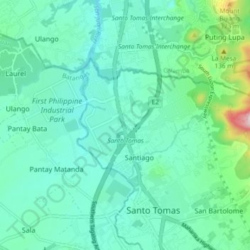
Name: San Rafael topographic map, elevation, terrain.
Average elevation: 518 ft
Minimum elevation: 292 ft
Maximum elevation: 1,509 ft
Other topographic maps
Click on a map to view its topography, its elevation and its terrain.
San Luis
Philippines > Batangas > Santo Tomas
San Luis, Santo Tomas, Batangas, Calabarzon, 4234, Philippines
Average elevation: 961 ft
Santo Tomas
Philippines > Batangas > Santo Tomas > Santo Tomas
Santo Tomas, Batangas, Calabarzon, 4234, Philippines
Average elevation: 505 ft