
Yenimahalle topographic map
Interactive map
Click on the map to display elevation.
About this map
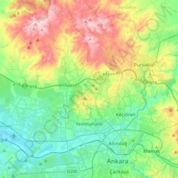
Name: Yenimahalle topographic map, elevation, terrain.
Location: Yenimahalle, Ankara, Central Anatolia Region, Turkey (39.91036 32.56364 40.10616 32.84706)
Average elevation: 3,114 ft
Minimum elevation: 2,569 ft
Maximum elevation: 4,872 ft