
South Holland topographic map
Interactive map
Click on the map to display elevation.
About this map
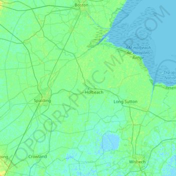
Name: South Holland topographic map, elevation, terrain.
Average elevation: 10 ft
Minimum elevation: -7 ft
Maximum elevation: 39 ft
Other topographic maps
Click on a map to view its topography, its elevation and its terrain.
Sutton Bridge
United Kingdom > England > South Holland > Sutton Bridge
Sutton Bridge, South Holland, Lincolnshire, East Midlands, England, PE12 9UG, United Kingdom
Average elevation: 13 ft