
Uruca topographic map
Interactive map
Click on the map to display elevation.
About this map
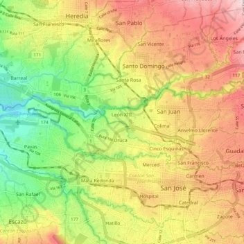
Name: Uruca topographic map, elevation, terrain.
Location: Uruca, Cantón San José, Provincia San José, 10107, Costa Rica (9.94305 -84.18003 9.97203 -84.08531)
Average elevation: 3,609 ft
Minimum elevation: 3,054 ft
Maximum elevation: 4,984 ft