
RW 11 topographic map
Interactive map
Click on the map to display elevation.
About this map
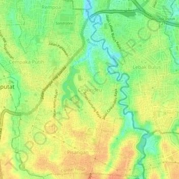
Name: RW 11 topographic map, elevation, terrain.
Location: RW 11, Cireundeu, South Tangerang, Banten, 15411, Indonesia (-6.32677 106.74688 -6.28677 106.78688)
Average elevation: 148 ft
Minimum elevation: 75 ft
Maximum elevation: 200 ft
Other topographic maps
Click on a map to view its topography, its elevation and its terrain.
Cireundeu
Indonesia > Banten > South Tangerang > Cireundeu
Cireundeu, Ciputat Timur, South Tangerang, Banten, 15419, Indonesia
Average elevation: 141 ft