
Utrecht topographic map
Interactive map
Click on the map to display elevation.
About this map
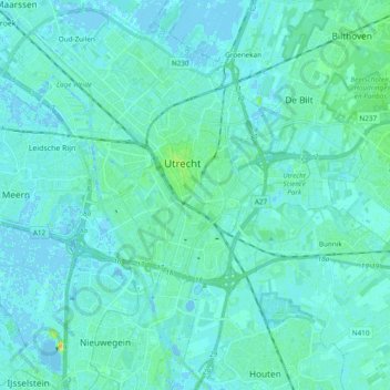
Name: Utrecht topographic map, elevation, terrain.
Location: Utrecht, Netherlands (52.02628 5.00418 52.13567 5.19516)
Average elevation: 10 ft
Minimum elevation: -13 ft
Maximum elevation: 66 ft