
Port Blair topographic map
Interactive map
Click on the map to display elevation.
About this map
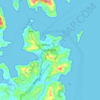
Name: Port Blair topographic map, elevation, terrain.
Average elevation: 89 ft
Minimum elevation: -7 ft
Maximum elevation: 1,480 ft
Other topographic maps
Click on a map to view its topography, its elevation and its terrain.
Austinabad
India > Andaman and Nicobar Islands > Port Blair Tehsil > Port Blair
Austinabad, Port Blair, Port Blair Tehsil, South Andaman District, Andaman and Nicobar Islands, 744112, India
Average elevation: 75 ft
Haddo
India > Andaman and Nicobar Islands > Port Blair Tehsil > Port Blair
Haddo, Port Blair, Port Blair Tehsil, South Andaman District, Andaman and Nicobar Islands, 744102, India
Average elevation: 33 ft