
Gaanderen topographic map
Interactive map
Click on the map to display elevation.
About this map
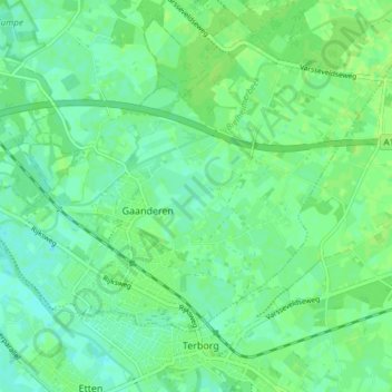
Name: Gaanderen topographic map, elevation, terrain.
Location: Gaanderen, Doetinchem, Gelderland, Nederland (51.92278 6.32147 51.95460 6.39629)
Average elevation: 56 ft
Minimum elevation: 36 ft
Maximum elevation: 69 ft
Other topographic maps
Click on a map to view its topography, its elevation and its terrain.
Wijnbergen
Nederland > Gelderland > Doetinchem
Wijnbergen, Doetinchem, Gelderland, Nederland, 7007 CA, Nederland
Average elevation: 49 ft
Wehl
Nederland > Gelderland > Doetinchem
Wehl, Doetinchem, Gelderland, Nederland
Average elevation: 46 ft