
Nes topographic map
Interactive map
Click on the map to display elevation.
About this map
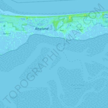
Name: Nes topographic map, elevation, terrain.
Location: Nes, Ameland, Friesland, Nederland (53.37667 5.72025 53.47367 5.79250)
Average elevation: 0 ft
Minimum elevation: -10 ft
Maximum elevation: 43 ft
Other topographic maps
Click on a map to view its topography, its elevation and its terrain.