
Nijverdal topographic map
Interactive map
Click on the map to display elevation.
About this map
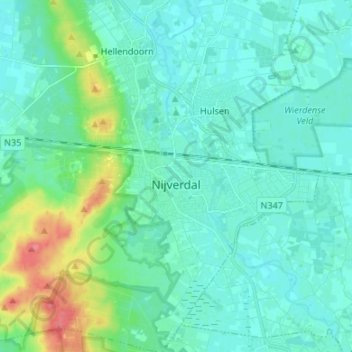
Name: Nijverdal topographic map, elevation, terrain.
Location: Nijverdal, Hellendoorn, Overijssel, Netherlands, The Netherlands (52.32006 6.41584 52.40182 6.52079)
Average elevation: 52 ft
Minimum elevation: 16 ft
Maximum elevation: 230 ft