
Woudenberg topographic map
Interactive map
Click on the map to display elevation.
About this map
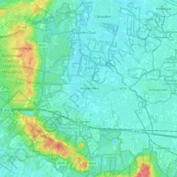
Name: Woudenberg topographic map, elevation, terrain.
Location: Woudenberg, Utrecht, Netherlands, The Netherlands (52.04312 5.29830 52.11743 5.49788)
Average elevation: 43 ft
Minimum elevation: 3 ft
Maximum elevation: 217 ft
Dutch Topographic map of the municipality of Woudenberg, 2013.