Geolocate

Bocholt topographic map

Interactive map

Click on the map to display elevation.

About this map

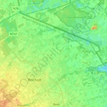
Name: Bocholt topographic map, elevation, terrain.

Location: Bocholt, Maaseik, Limburg, Vlaanderen, 3950, België (51.16201 5.53360 51.22290 5.65946)

Average elevation: 125 ft

Minimum elevation: 82 ft

Maximum elevation: 184 ft

Other topographic maps

Click on a map to view its topography, its elevation and its terrain.

Kaulille

België > Limburg > Maaseik > Bocholt

Kaulille, Bocholt, Maaseik, Limburg, Vlaanderen, België

Average elevation: 144 ft

Veldhoven

België > Limburg > Maaseik > Bocholt

Veldhoven, Bocholt, Maaseik, Limburg, Vlaanderen, 3950, België

Average elevation: 131 ft

Reppel

België > Limburg > Maaseik > Bocholt

Reppel, Bocholt, Maaseik, Limburg, Vlaanderen, België

Average elevation: 171 ft