
Lovendegem topographic map
Interactive map
Click on the map to display elevation.
About this map
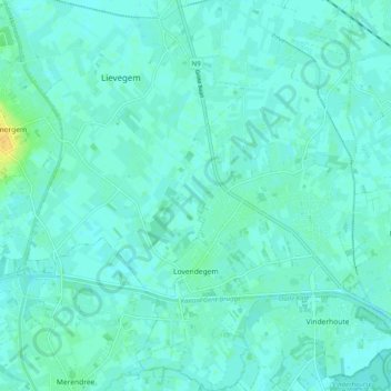
Name: Lovendegem topographic map, elevation, terrain.
Location: Lovendegem, Lievegem, Gent, East Flanders, Flanders, Belgium (51.07646 3.58642 51.13907 3.65269)
Average elevation: 20 ft
Minimum elevation: 7 ft
Maximum elevation: 82 ft
Other topographic maps
Click on a map to view its topography, its elevation and its terrain.
Zomergem
Belgium > East Flanders > Gent > Lievegem
Zomergem, Lievegem, Gent, East Flanders, Flanders, 9930, Belgium
Average elevation: 26 ft