
Temse topographic map
Interactive map
Click on the map to display elevation.
About this map
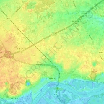
Name: Temse topographic map, elevation, terrain.
Location: Temse, Sint-Niklaas, East Flanders, Flanders, Belgium (51.10879 4.17722 51.17561 4.25034)
Average elevation: 52 ft
Minimum elevation: -10 ft
Maximum elevation: 98 ft