
Jabbeke topographic map
Interactive map
Click on the map to display elevation.
About this map
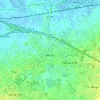
Name: Jabbeke topographic map, elevation, terrain.
Location: Jabbeke, West Flanders, Flanders, Belgium (51.16339 3.05174 51.20545 3.11810)
Average elevation: 16 ft
Minimum elevation: -7 ft
Maximum elevation: 49 ft