
Sheepy topographic map
Interactive map
Click on the map to display elevation.
About this map
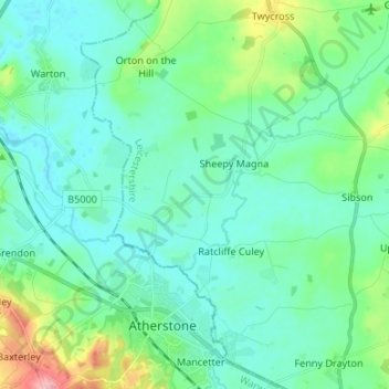
Name: Sheepy topographic map, elevation, terrain.
Average elevation: 285 ft
Minimum elevation: 207 ft
Maximum elevation: 594 ft
Other topographic maps
Click on a map to view its topography, its elevation and its terrain.
Tweed River
United Kingdom > England > Hinckley and Bosworth
Tweed River, Hinckley and Bosworth, Leicestershire, East Midlands, England, CV13 6DS, United Kingdom
Average elevation: 322 ft