
La Sobala topographic map
Interactive map
Click on the map to display elevation.
About this map
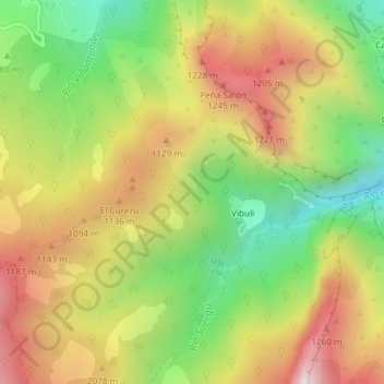
Name: La Sobala topographic map, elevation, terrain.
Location: La Sobala, Ponga, Asturias, Spain (43.17337 -5.12083 43.19337 -5.10083)
Average elevation: 3,130 ft
Minimum elevation: 1,811 ft
Maximum elevation: 4,528 ft
Other topographic maps
Click on a map to view its topography, its elevation and its terrain.