
Sungurlare topographic map
Interactive map
Click on the map to display elevation.
About this map
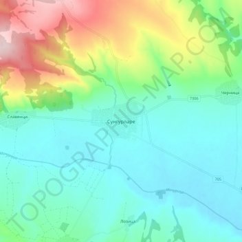
Name: Sungurlare topographic map, elevation, terrain.
Location: Sungurlare, Burgas, 8470, Bulgaria (42.72311 26.73726 42.80311 26.81726)
Average elevation: 840 ft
Minimum elevation: 581 ft
Maximum elevation: 1,549 ft
Other topographic maps
Click on a map to view its topography, its elevation and its terrain.