
Eustis topographic map
Interactive map
Click on the map to display elevation.
About this map
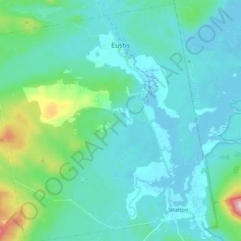
Name: Eustis topographic map, elevation, terrain.
Location: Eustis, Franklin County, Maine, 04936, United States (45.12648 -70.56617 45.23802 -70.41692)
Average elevation: 1,355 ft
Minimum elevation: 1,129 ft
Maximum elevation: 2,700 ft