
الزهور topographic map
Interactive map
Click on the map to display elevation.
About this map
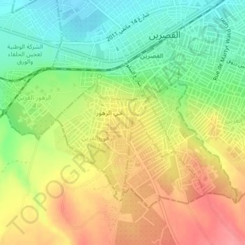
Name: الزهور topographic map, elevation, terrain.
Location: الزهور, Kasserine, Tunisia (35.14922 8.81292 35.16845 8.84649)
Average elevation: 2,293 ft
Minimum elevation: 2,162 ft
Maximum elevation: 2,431 ft
Other topographic maps
Click on a map to view its topography, its elevation and its terrain.