
Anantnag topographic map
Interactive map
Click on the map to display elevation.
About this map
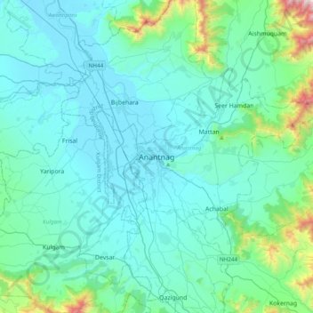
Name: Anantnag topographic map, elevation, terrain.
Location: Anantnag, Jammu and Kashmir, India (33.57664 74.98574 33.89664 75.30574)
Average elevation: 5,856 ft
Minimum elevation: 5,210 ft
Maximum elevation: 10,466 ft
Other topographic maps
Click on a map to view its topography, its elevation and its terrain.
Achabal
India > Jammu and Kashmir > Anantnag > Achabal
Achabal, Anantnag, Anantnag District, Jammu and Kashmir, 192201, India
Average elevation: 5,623 ft