
Nakthan topographic map
Interactive map
Click on the map to display elevation.
About this map
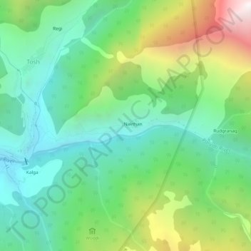
Name: Nakthan topographic map, elevation, terrain.
Location: Nakthan, Kullu, Himachal Pradesh, India (31.98420 77.44926 32.02420 77.48926)
Average elevation: 9,035 ft
Minimum elevation: 6,978 ft
Maximum elevation: 13,524 ft