
Banjarmasin topographic map
Interactive map
Click on the map to display elevation.
About this map
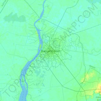
Name: Banjarmasin topographic map, elevation, terrain.
Location: Banjarmasin, South Kalimantan, 70231, Indonesia (-3.47875 114.43258 -3.15875 114.75258)
Average elevation: 13 ft
Minimum elevation: -3 ft
Maximum elevation: 75 ft
Other topographic maps
Click on a map to view its topography, its elevation and its terrain.
Telaga Biru
Indonesia > South Kalimantan > Banjarmasin > Telaga Biru
Telaga Biru, West Banjarmasin, Banjarmasin, South Kalimantan, 70119, Indonesia
Average elevation: 16 ft
Pasar Lama
Indonesia > South Kalimantan > Banjarmasin > Pasar Lama
Pasar Lama, Central Banjarmasin, Banjarmasin, South Kalimantan, 70115, Indonesia
Average elevation: 20 ft