
Sông Hinh District topographic map
Interactive map
Click on the map to display elevation.
About this map
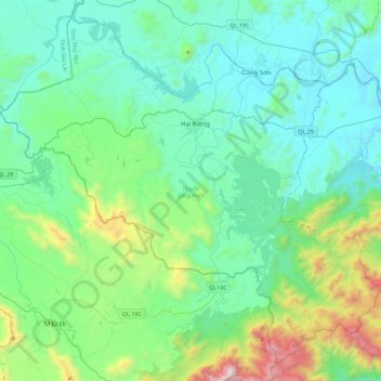
Name: Sông Hinh District topographic map, elevation, terrain.
Location: Sông Hinh District, Phu Yen province, Vietnam (12.70648 108.67259 13.10129 109.11801)
Average elevation: 1,227 ft
Minimum elevation: 33 ft
Maximum elevation: 6,476 ft
Other topographic maps
Click on a map to view its topography, its elevation and its terrain.