Porters Corner topographic map
Interactive map
Click on the map to display elevation.
About this map
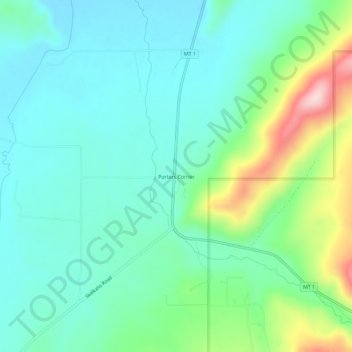
Name: Porters Corner topographic map, elevation, terrain.
Average elevation: 5,509 ft
Minimum elevation: 5,285 ft
Maximum elevation: 6,165 ft

Click on the map to display elevation.
Name: Porters Corner topographic map, elevation, terrain.
Average elevation: 5,509 ft
Minimum elevation: 5,285 ft
Maximum elevation: 6,165 ft