
Oro Verde topographic map
Interactive map
Click on the map to display elevation.
About this map
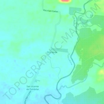
Name: Oro Verde topographic map, elevation, terrain.
Location: Oro Verde, Cantón Quinsaloma, Los Ríos, Ecuador (-1.11153 -79.35013 -1.07153 -79.31013)
Average elevation: 269 ft
Minimum elevation: 230 ft
Maximum elevation: 423 ft