
Chandannagar topographic map
Interactive map
Click on the map to display elevation.
About this map
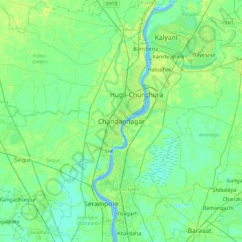
Name: Chandannagar topographic map, elevation, terrain.
Average elevation: 26 ft
Minimum elevation: -10 ft
Maximum elevation: 98 ft
Chandannagar is located at 22°52′N 88°23′E / 22.87°N 88.38°E / 22.87; 88.38. It has an average elevation of 10 metres (33 ft).
Other topographic maps
Click on a map to view its topography, its elevation and its terrain.
Saraswati
India > West Bengal > Singur > Chandannagar
Saraswati, Chandannagar, Singur, Hugli, West Bengal, India
Average elevation: 30 ft