
Alanya topographic map
Interactive map
Click on the map to display elevation.
About this map
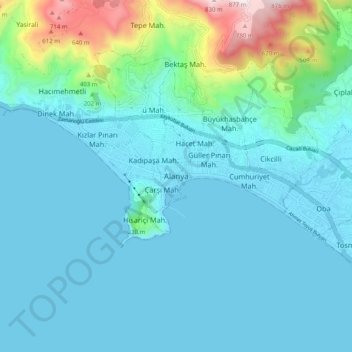
Name: Alanya topographic map, elevation, terrain.
Location: Alanya, Antalya, Mediterranean Region, 74000, Turkey (36.50365 31.96192 36.58365 32.04192)
Average elevation: 404 ft
Minimum elevation: -10 ft
Maximum elevation: 2,785 ft