
Frenchman Island topographic map
Interactive map
Click on the map to display elevation.
About this map
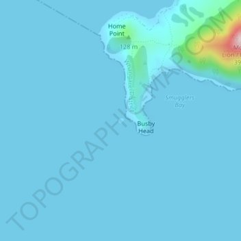
Name: Frenchman Island topographic map, elevation, terrain.
Location: Frenchman Island, Whangarei, Northland, New Zealand (-35.86114 174.52727 -35.86054 174.52810)
Average elevation: 46 ft
Minimum elevation: 0 ft
Maximum elevation: 1,102 ft